mapNYC-760x507.jpg
Olivia DrakeFebruary 23, 20212min
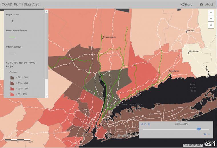
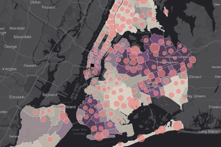
Throughout the COVID-19 pandemic, the public has relied on dynamic visualizations in the form of maps and apps to keep up-to-date with the spread of the disease on both local and global scales. And with the use of geo-enabled apps, individuals can locate COVID-19 testing and vaccination sites, order groceries and other goods online, find uncrowded outdoor spaces, and track and even map the number of available medical resources in area hospitals. "All of these services are available due to geographic information systems (GIS)," said Kim Diver, associate professor of the practice in earth and environmental sciences. "By using spatiotemporal visualizations, we…

COVIDmap-760x517.jpg
Olivia DrakeMay 11, 20202min
In late March, as New York City's coronavirus infection rate skyrocketed to five times higher than the rest of the country, members of Wesleyan's Traveler's Lab explored a movement-focused approach to the rapid spread of the disease. Rather than focusing on political borders, lab members depicted major freeways, highways, and commuter rail lines out of New York City, and examined counties within a 2.5-hour drive from the City. "While New York City may be the center, it is the travel region immediately surrounding the city that provides the true context of how COVID-19 has spread and is spreading to, and…