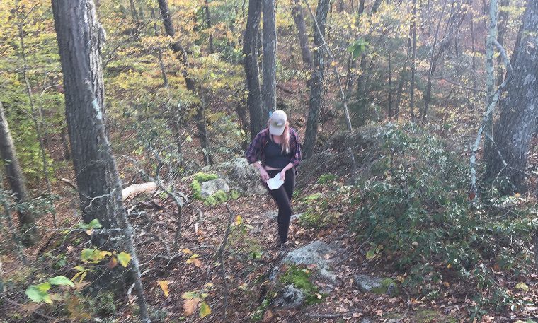
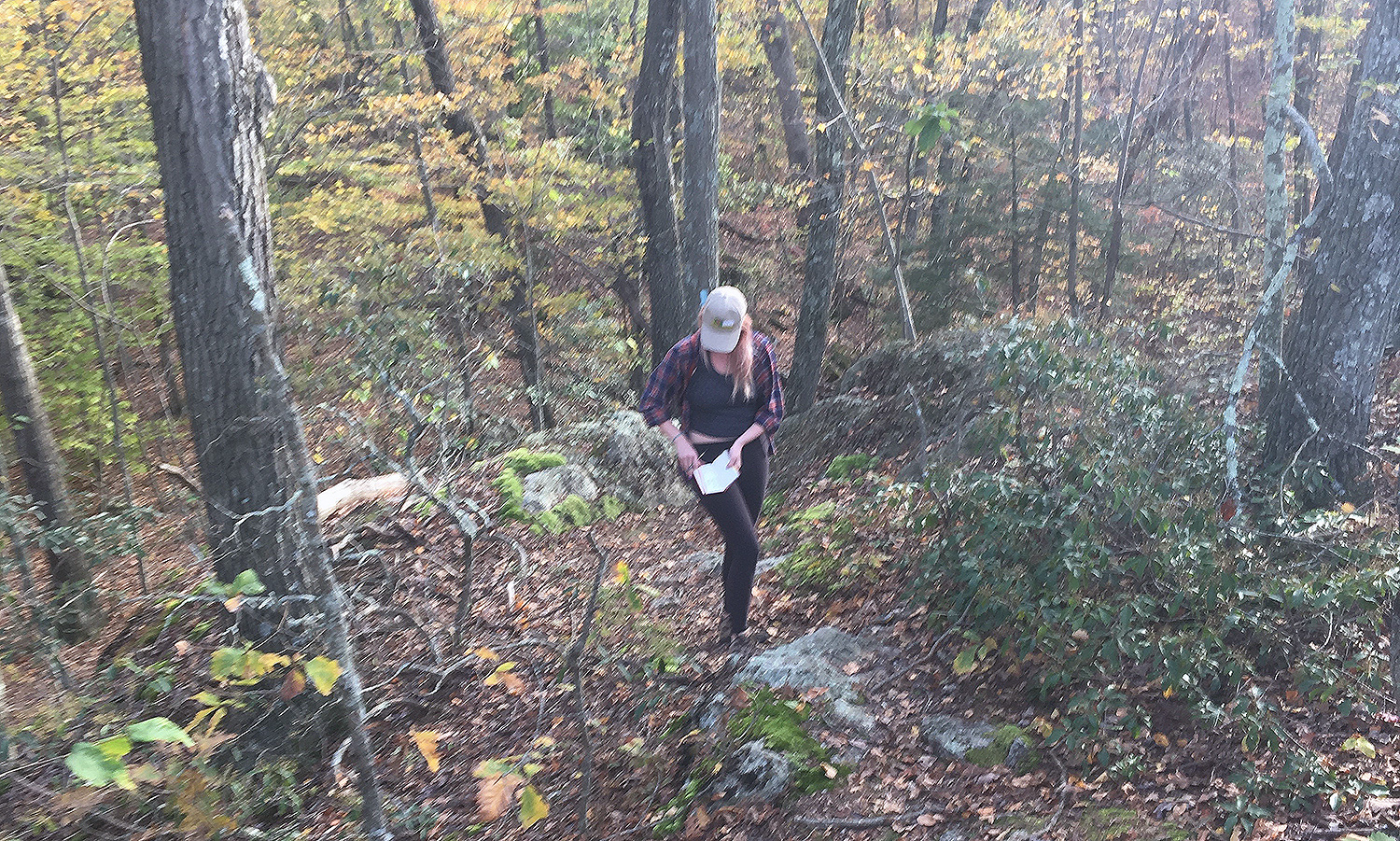
Earth and environmental sciences major Jackie Buskop ’19 collects field data along a hiking trail in Connecticut while working on a class project. (Photo by Melissa Luna)
Last fall, 19 students enrolled in the Earth and Environmental Sciences 280 course, Introduction to GIS, assisted a local organization while learning data analysis skills.
At the start of the semester, the class teamed up with community partner Emma Kravet, education director at the Connecticut Forest & Park Association (CFPA). Kravet expressed a need for a mapping tool that shows the location of schools and other community resources near the CFPA’s blue-blazed hiking trail system. If such a map existed, she could facilitate more meaningful connections to schools and organizations near the trails.
The class broke into five thematic groups to address the CFPA’s needs: recreation, environment, trail access, educational opportunities and public history.
Students first learned about GIS (geographic information systems) and ways they could capture, organize, store, edit, analyze and display spatial and geographic data.
“GIS has applications in a wide variety of fields, including the natural sciences, public policy, business and the humanities—literally any field that uses spatially distributed information,” said course instructor Kim Diver, assistant professor of the practice in earth and environmental sciences.
They stored data in a mapping and analytics platform called ArcGIS and used an app called Story Maps to visually display and explore their results.
On Dec. 8, the students presented their maps to staff from the Connecticut Forest & Park Association, including Emma Kravet; Clare Cain, trails stewardship director; Eric Hammerling, executive director; and Colin Carroll, trails program field coordinator.
“Students gained applied GIS skills,” Diver said, “but as a community-based service learning project, students were able to integrate academic matter and community engagement with critical reflection.”
The projects are listed below:
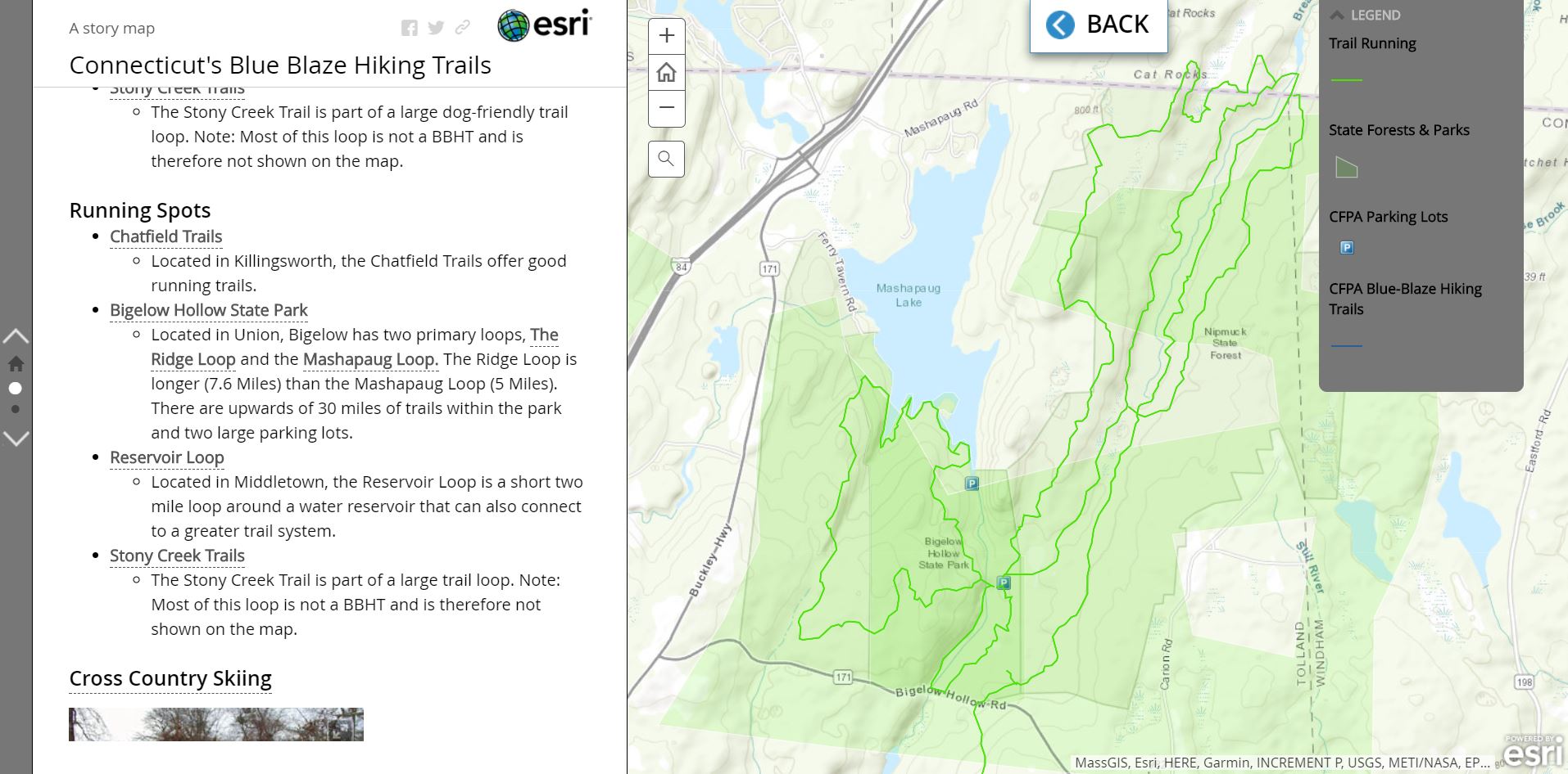
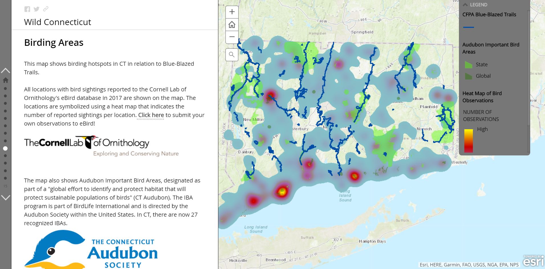
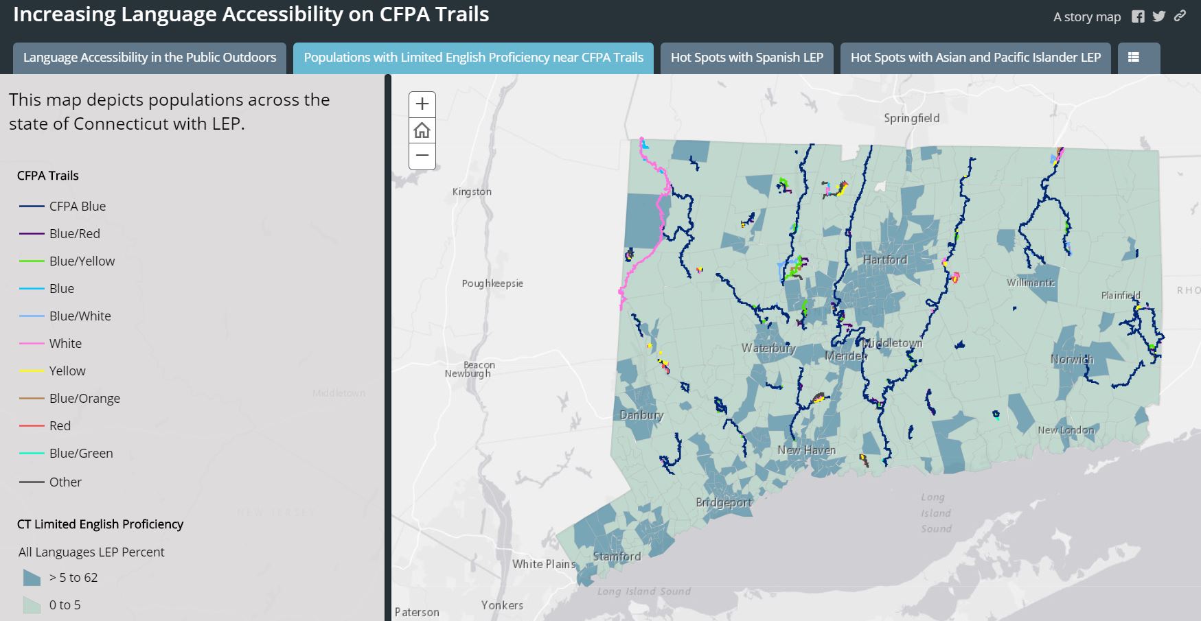
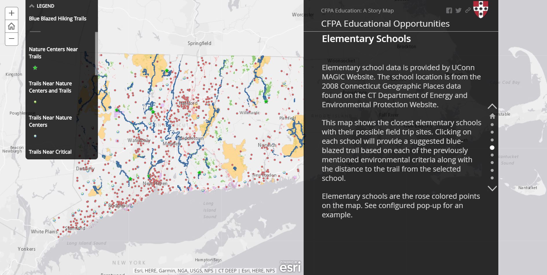
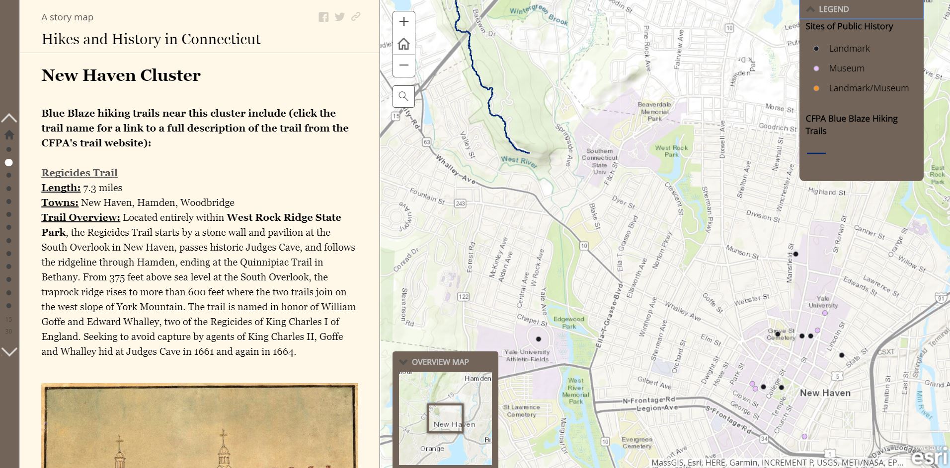
The recreation group designed a Story Map titled “Connecticut’s Blue Blaze Hiking Trails.” The blue-blazed hiking trail system is a series of trails throughout the state totaling 825 miles in distance. Group members Rhoen Fiutak ’19 and Sarah Mount ’20 created a Story Map that offers a glimpse of recreational sites near the trail system, including areas for dog walking, mountain biking, boat launching, fishing, running and more.The environment group created a Story Map titled “Wild Connecticut.” It examines key intersections between CFPA trails and natural resources, including critical habitats, commonly sighted and endangered animals and geological features. Team members included Jackie Buskop ’19, Hedi Droste ’19, Virginia Johnson ’18, Maddie Nash ’18, Tristan Stetson ’20 and Robin Waterman ’19.The trail access group created a Story Map titled “Increasing Language Accessibility on CFPA Trails.” The map provides information on populations with limited English proficiency near CFPA trails. Group members included Sophia Ptacek ’18, Kelly Lam ’19, Azher Jaweed ’19 and Hannah Wilton ’18. “Some areas in Connecticut have a 40 percent limited English proficiency, and signs on the trails are primarily in English,” Lam explained. “These hikers could get lost or trespass without knowing.”The education group created a Story Map titled “CFPA Educational Opportunities.” The map shows locations of elementary schools throughout the state of Connecticut that are close to a blue-blazed trail, critical habitats and bodies of water. Group members included Tyler Barnes ’18, Sara Bennett ’18, Mariel Hohmann ’18, Sage Loomis ’18 and Paul Franceschi ’19. “Our goal was to find possible field trip opportunities for these schools,” Bennett said. “[In our map], you click on a school and a menu will pop up and you can search by criteria—how close is the school to a state park, a water body, a nature center or a birding area?”The public history group created a Story Map titled “Hikes and History in Connecticut.” Steven Chen ’18 and Ilana Newman ’18 located multiple cultural sites near hiking trails that provide an opportunity to explore new methods of learning.