The posters highlighted the students’ semester-long research and service-learning projects incorporating applications of advanced geographic information systems skills.
The project-based course E&ES 344 is taught by Kim Diver, assistant professor of the practice of earth and environmental sciences, and is part of the Academy for Project-Based Teaching and Learning hosted by the Center for Pedagogical Innovation.
“The 14 students in the course conducted independent research projects, worked with faculty on their research projects, or collaborated with community partners on service-learning projects,” Diver explained.
Half of the course’s projects were represented at the conference.
Participants included Sophie Breitbart ’16, Stephanie Ling ’16, Laura Dempsey ’16, Pierre Gerard ’16, John Hossain ’16, Jesse Tarnas ’16, Jed Siebert ’16 and Avi Stein ’17.
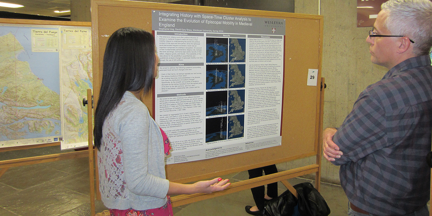
Ling won the poster contest with her innovative spatial humanities research on examining the spatiotemporal mobility of bishops in Medieval England.
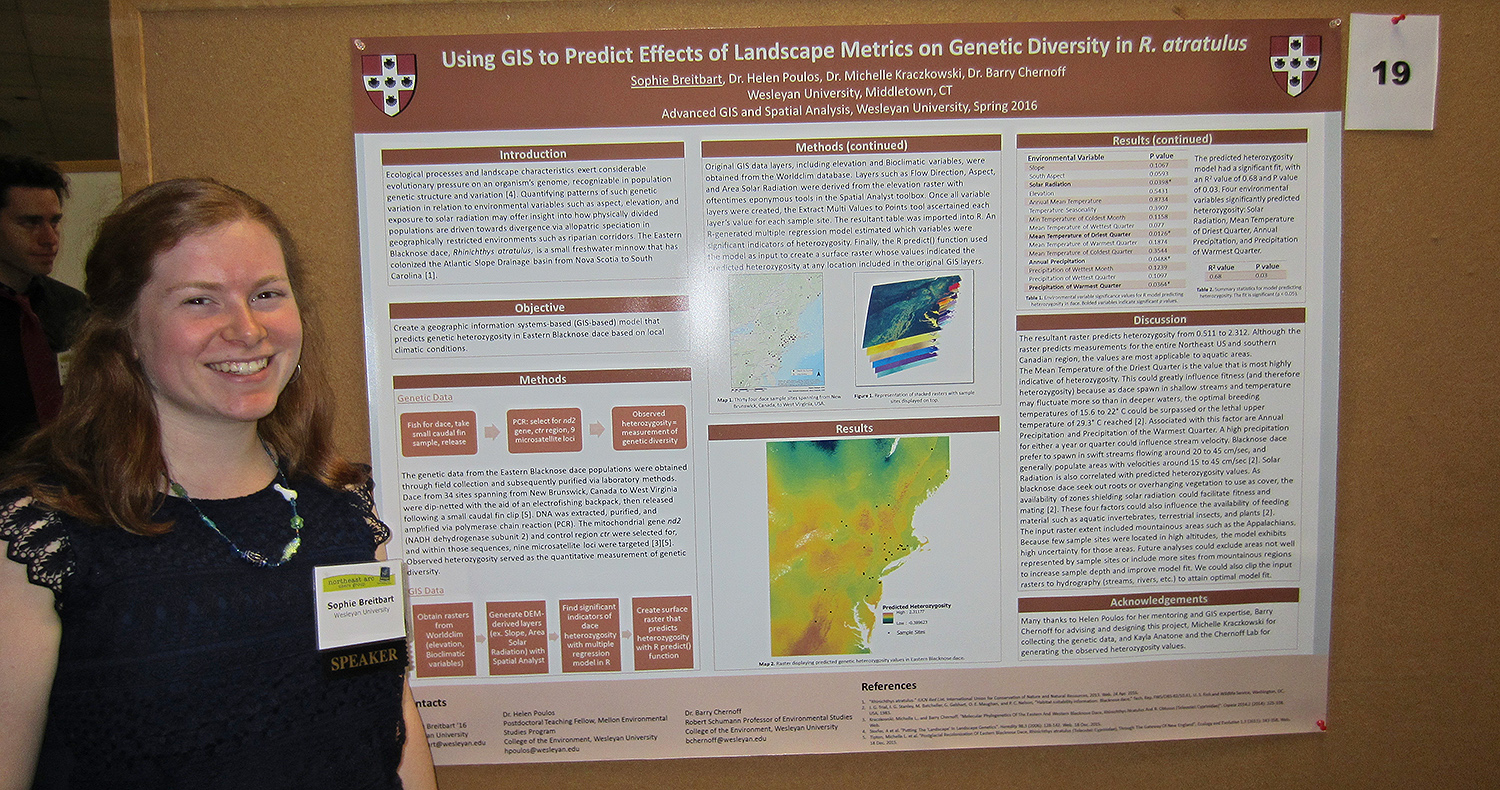
Sophie Breitbart ’16 presented her poster titled “Using GIS to Predict Effects of Landscape Metrics on Genetic Diversity in R. atratulus.” Breitbart’s objective was to create a GIS-based model that predicts patterns of genetic variation for the Eastern Blacknose Dace, Rhinichthys atratulus, based on the presence of environmental factors such as land cover type and elevation.
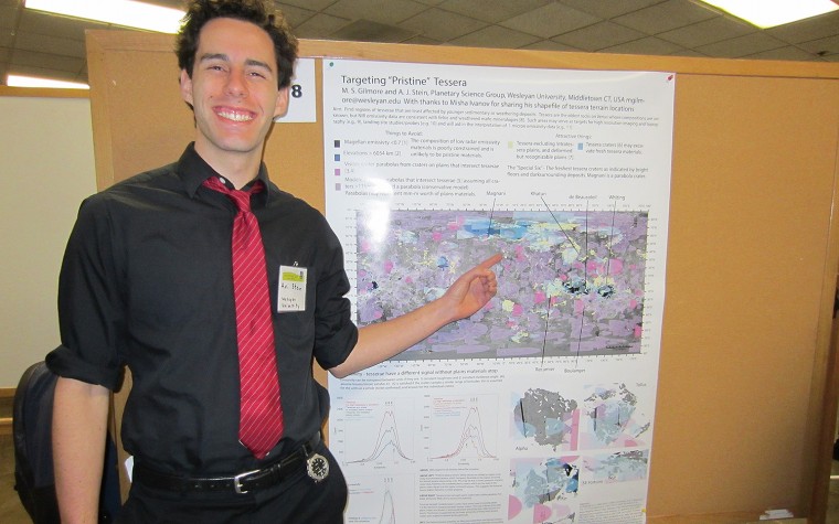
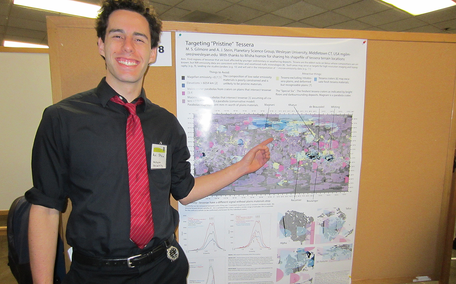
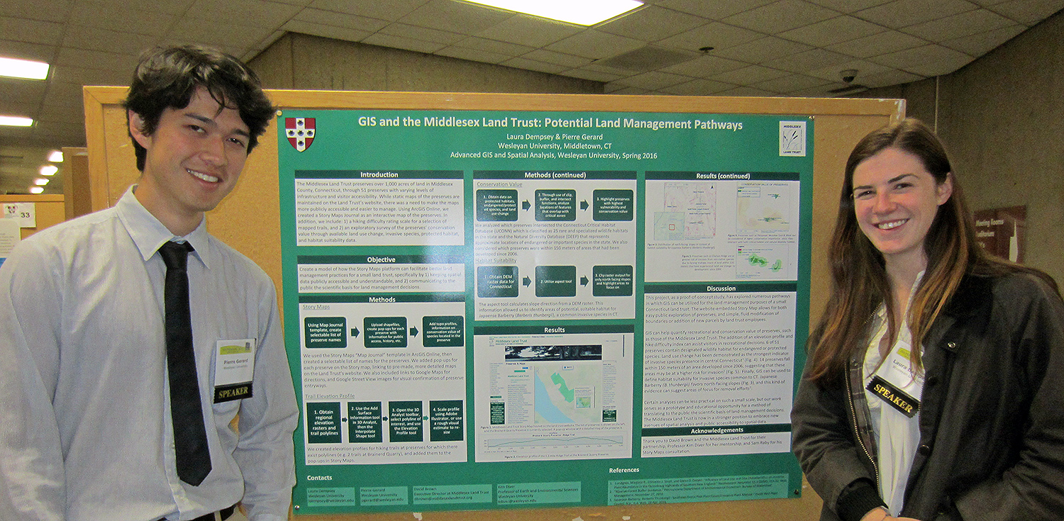
Stephanie Ling ’16 explains her prize-winning poster to a conference participant. Ling worked with Wesleyan Professor Gary Shaw on the study, titled “Integrating History with Space-Time Cluster Analysis to Examine the Evolution of Episcopal Mobility in Medieval England.”Avi Stein ’17 presented his research titled “Mapping ‘Pristine’ Tessera Regions on Venus.” From isotope fractionation, scientists know Venus used to have huge reserves of water, but only 10 percent of the surface known as tessera regions, has mineralogical clues that may provide a window to the past. Stein used satellite imagery of Venus and raster analysis tools in a software called ArcMap to identify the tessera regions needed for his research.Pierre Gerard ’16 and Laura Dempsey ’16 presented a poster outlining service-learning work for the Middlesex Land Trust. Their project was titled “Potential Land Management Pathways.” The students created a Story Map Journal for the Middlesex Land Trust on ArcGIS Online to integrate information about each of the preserves with interactive maps. In addition, they performed a series of spatial analyses, including: 1) a hiking difficulty rating scale for a selection of mapped trails and 2) ranking the conservation value of the preserves through available land-use change, invasive species, protected habitat, and habitat suitability data.